NSFC Project
Grant No. 42201446, ¥300,000
Title: An Augmented Representation Method of Disaster Virtual Geographic Environment with Visual Saliency Constraints
Sponsor: National Natural Science Foundation of China
Duration: 2023.01 – 2025.12
Key words: Virtual geographic environment; Disaster information; Augmented representation; Visual saliency; Intelligent recommendation
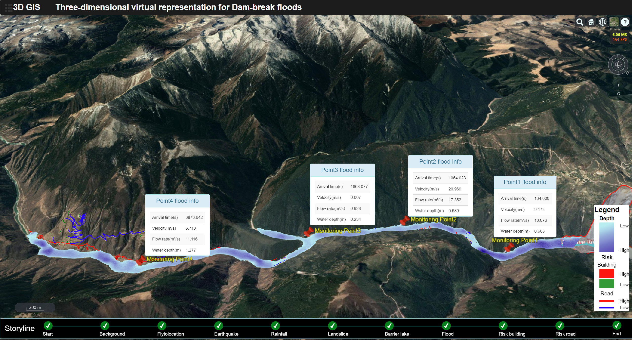
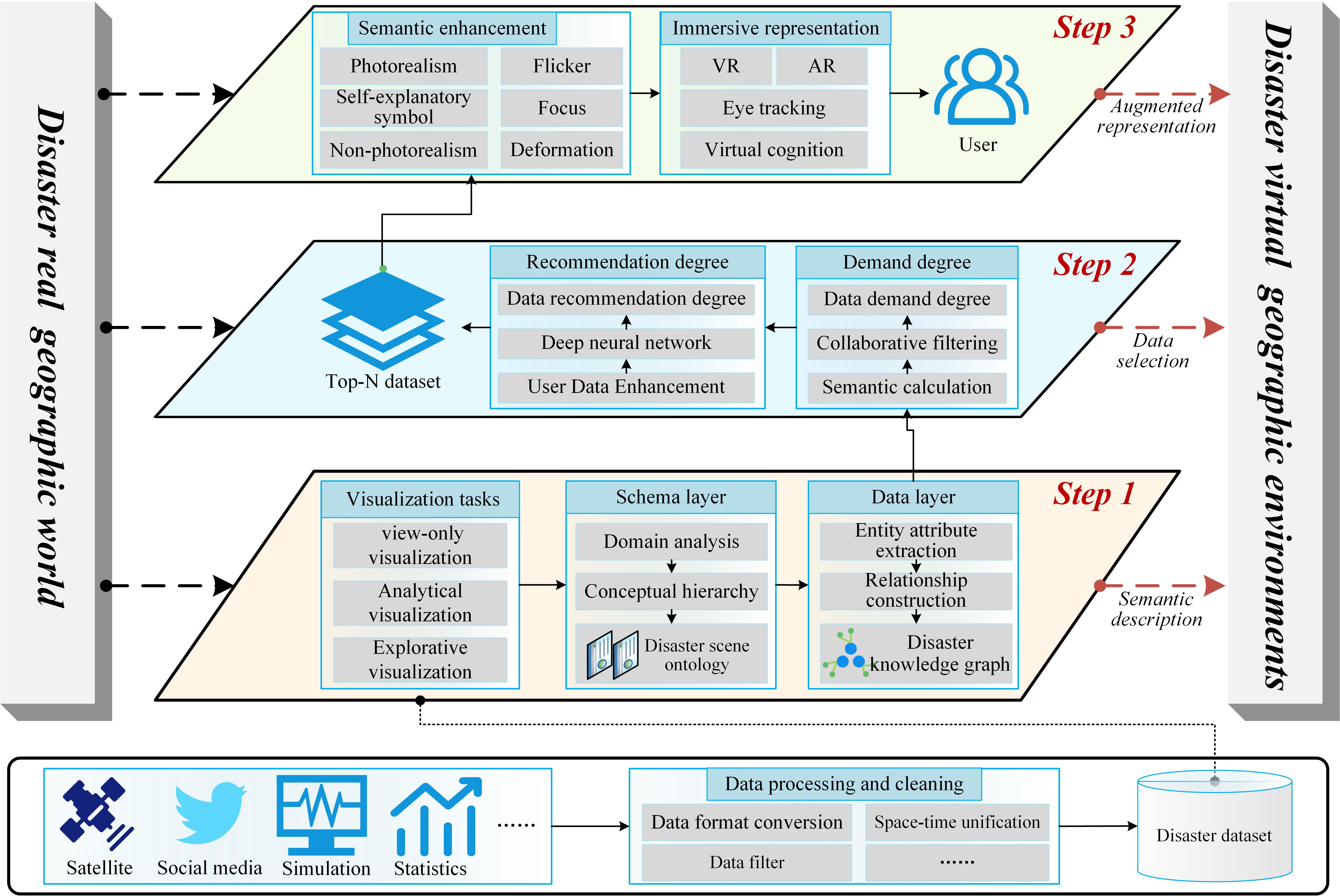
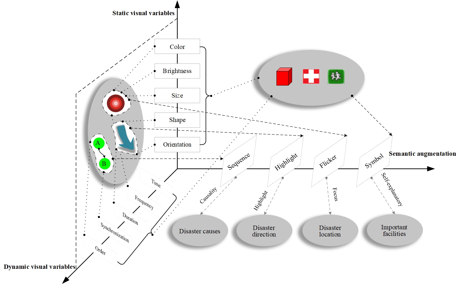
Abstract: It is of great importance and urgency for disaster prevention and mitigation to construct a virtual geographic environment for disaster information representation and sharing, to further assist in disaster decision-making, publicity and education, and to enhance people’s risk perception. However, existing disaster visualization methods do not consider the balance between the amount of scene information and cognitive load, which leads to some problems such as unfocused representation of disaster information, overcrowded and confused scenes, and low cognitive efficiency of users. This project will systematically research on augmented representation of disaster virtual geographic environment with visual saliency constraints. Specially, the project mainly includes the following parts: (1) the intelligent recommendation of disaster information taking into account user preferences, which optimizes the selection of relevant disaster information adaptive to user needs; (2) the augmented representation of disaster scenes guided by visual attention, which achieves rapid focus of scene information and improves user awareness; (3) the cognitive evaluation of disaster scenes based on virtual travel behavior, which is used to verify the effectiveness and efficiency of augmented representation. A prototype system is developed to conduct experiment analysis with flash flood and debris flow as typical examples. The expected results can improve the effectiveness of disaster information dissemination and user cognitive efficiency, and further promote the development of geospatial cognition and virtual geographical environment.