Weilian Li
Postdoctoral Research Associate | GISer & Cartographer

Computational Methods Lab
HafenCity University Hamburg
Henning-Voscherau-Platz 1, 20457 Hamburg, Germany
Hello, thanks for visiting my homepage!![]()
![]()
![]()
I am Weilian Li, working in the Computational Methods Lab led by Prof. Dr.-Ing. Youness Dehbi at the HafenCity University Hamburg, Germany. I received my Ph.D. in Geomatics Science and Technology at Southwest Jiaotong University, China, in December 2020. Then, I finished my postdoc research stay in the Geoinformation Group chaired by Prof. Dr.-Ing. Jan-Henrik Haunert at the University of Bonn in October 2023.
My research primarily focuses on the application of Geographic Information Systems (GIS) in disaster management, but also methodological expertise in Machine Learning. I have a strong interest in topics related to smart cities, disaster management, and digital twins.
Additionally, I hold the position of Topic Editor at the journal Big Earth Data and actively contribute to the GIS community as the secretary of the ISPRS ICWG III/IVa on Disaster Management and representative of the UN-GGIM Academic Network.
News
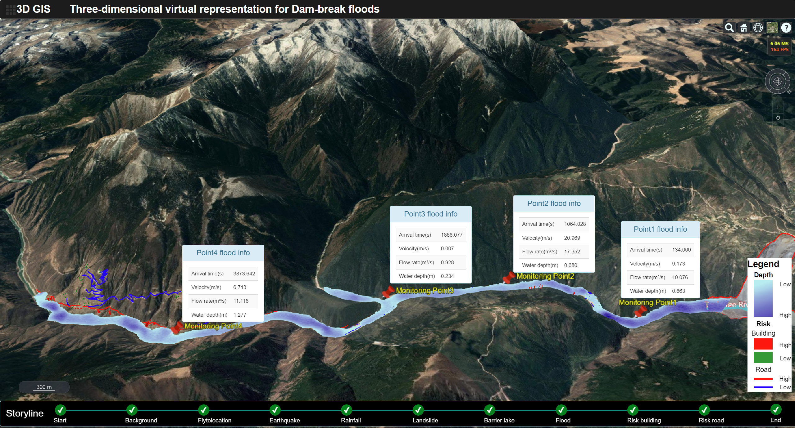
| Mar 9, 2024 | I’m happy to share that our article entitled “A 3D virtual geographic environment for flood representation towards risk communication” has been accepted for publication by the International Journal of Applied Earth Observation and Geoinformation |
|---|---|
| Dec 28, 2023 | I am pleased that our article entitled “Visual attention-guided augmented representation of geographic scenes: A case of bridge stress visualization” has been accepted for publication by the International Journal of Geographical Information Science |